One key objective of the ZAPÁS project (in close cooperation with the ESA project BIOMASAR-II) is the mapping and monitoring of growing stock volume at multiple scales. Different satellite data are being explored, for intance to track cover changes of the natural Taiga forest in the Krasnoyarsk and Irkutsk regions in Central Siberia. In the framework of the EU-Russia Space Dialogue data from the ESA ROSCOSMOS and JAXA Space Agencies are analyzed. After the first project year, the following data sourses are analysed:
- Very high resolution: RESURS DK-1 [5 m] (Validation)
- High resolution: ALOS PALSAR [25 m] (local to regional scale Growing Stock Volume mapping)
- Coarse resolution: ENVISAT ASAR [1 km] (regional scale Growing Stock Volume mapping)
In the framework of the JAXA Kyoto & Carbon Initiative a global mosaic of PALSAR FBD SAR data is generated by JAXA with a spatial resolution of 25 m containing HH and HV polarizations covering the years 2007 to 2010. The mosaic covers an area of 490.000 km², an area bigger than the size of Germany. To give an example, the substs below show the thematic information of each product. For detailed exploration the reader is referred to the ZAPÁS Map Portal.
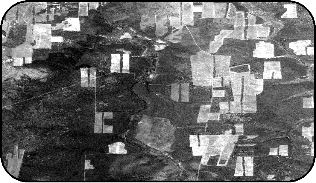
RESURS DK-1 – Panchromatic 5 m Image (2011)
The panchromatic image delineates in great detail the clear cuts. The colors indicate the age and regeneration status of the logging areas. The brighter the color of the clear cut, the more current was the logging event.
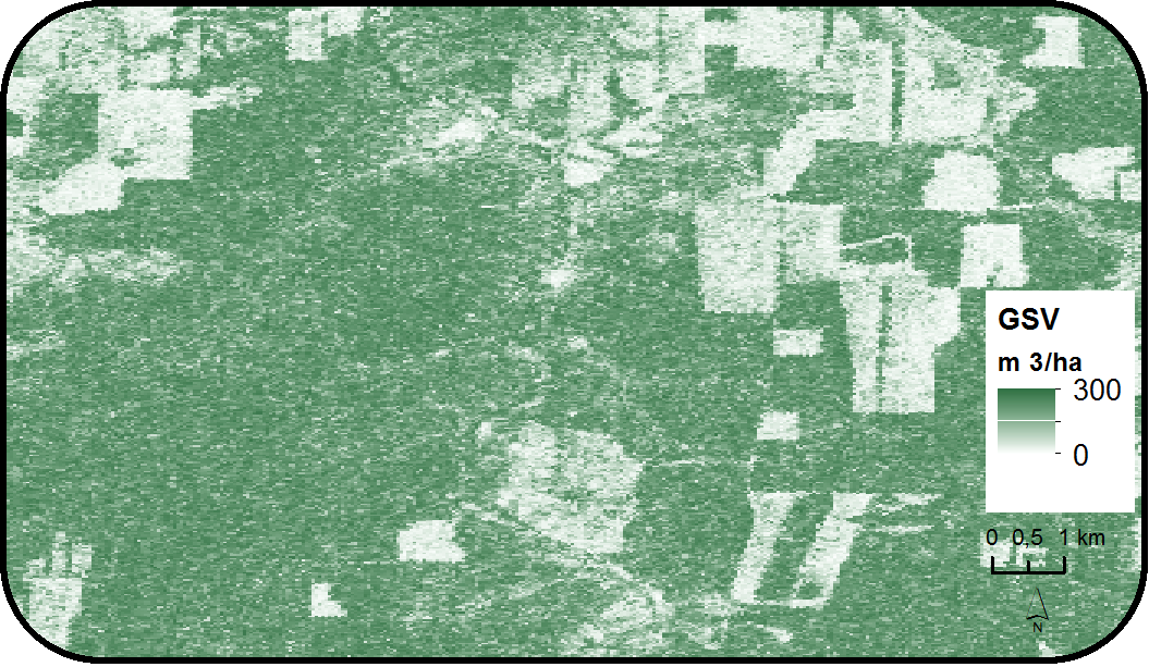
ALOS PALSAR – 25 m Growing Stock Volume map (2007)
Forest biomass distribution for the year 2007 in terms of growing stock volume is shown.
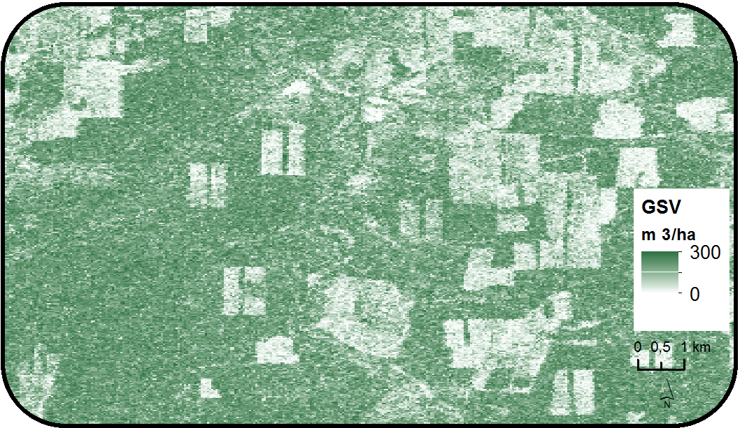
ALOS PALSAR – 25 m Growing Stock Volume map (2010)
Forest biomass distribution for the year 2010 in terms of growing stock volume is shown. Comparing the RESURS DK-1 image notable deforestation activities were detected between 2007 and 2010. Existing logging sites were extended and an increase of forest fragmentation was mapped since new logging sites appeared in homogeneous forest patches (center of the image).
ENVISAT ASAR – 1 km Growing Stock Volume Map
The subset of the pan-boreal BIOMASAR-II GSV map highlights the scaling effect on a 1 km scale. Huge connected logging sites appear as slightly decreased biomass areas compared to natural stands. Small scale clear cuts can not be detected at that scale.


