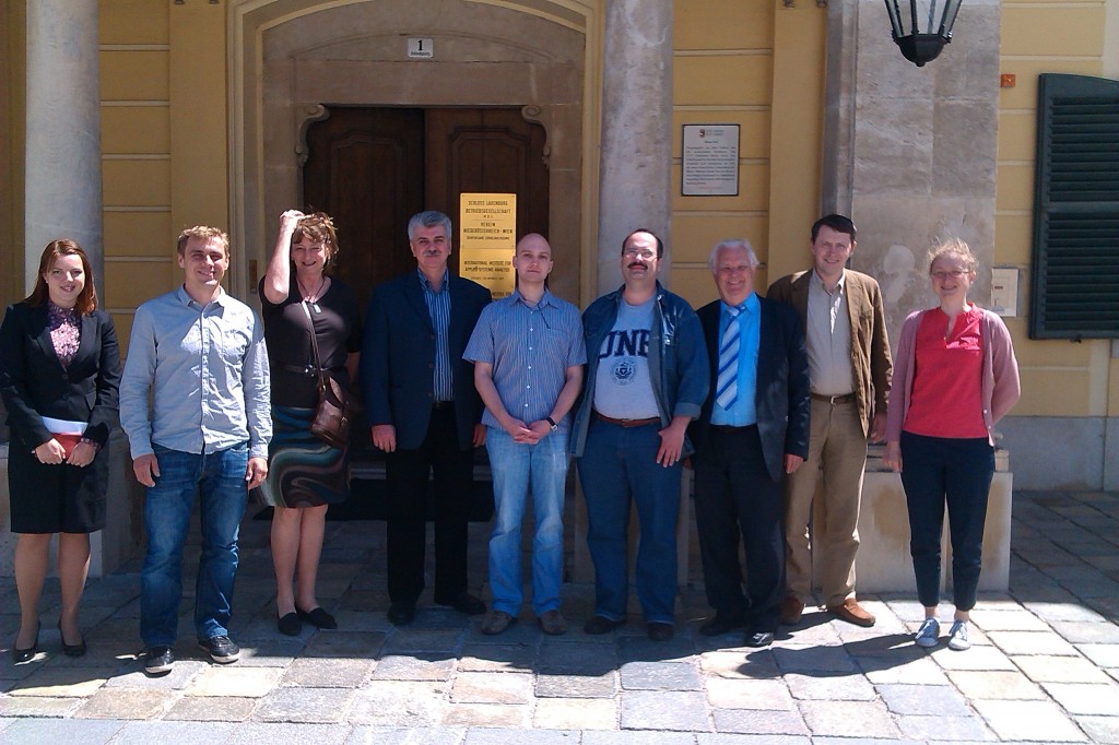
The two days ZAPÁS validation workshop started on Tuesday 14 May with a welcoming by Anatoly Shvidenko followed by a project status presentation given by Christian Hüttich. The Meeting aimed to prepare a road map for the next steps, in particular how to operationalize and implement developed methods, derive product validation information and prepare the task on terrestrial carbon accounting for Central Siberia.
The status of the available forest inventory was presented by Mikhail Korets. The inventory could be provided for all local test sites. It was stated that in some cases the old inventory is (probably) more accurate than the most recent update. Reasons could be that information was eventually transferred from old maps from the 70ies. The local scale mapping (methods and products) was presented by the FSU team.

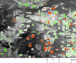
Local stite deforestation and reforestation maps (2007 - 2010) in Central Siberia based on 25 m ALOS PALSAR imagery. Red patches indicate deforestation. Green areas indicate reforestation patterns (overlain a RESURS DK-1 pancromatic image).
At this stage of the project all forest resource geo-information products (Biomass, Forest cover and disturbances, Reforestation on abandoned lands) are finalized and being cross-compared by the team. Comparisons of satellite-based GSV with forest inventory showed lower agreements on local scale than on (coarse) regional scales. Reasons could be higher uncertainties in the forest inventory data on site level but also increased deviations of GSV maps. The MODIS derived land cover showed in general good agreements with the FI data. Some class confusions occurred in the humid grasslands class. Further comparisons with a harmonized legend system have to be conducted in order to assign the error either to the FI data or to the MODIS land cover product.

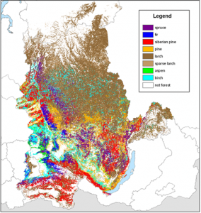
Forest species map based on 250 m MODIS time series data indicating the dominant species occurrence for Central Siberia.
Comparisons of the MODIS forest species map showed for some sites significant differences in the species composition that have to be intensively analyzed and understood in the future project activities. Important preparations were conducted and presented by IIASA for the upcoming task of improving the full terrestrial carbon account for the project area of Central Siberia. Comparisons of the 1 km ASAR (BIOMASAR-II) biomass map showed good agreement with the national scale forest inventory data.
In summary, the potential of the EO based land cover, biomass, and change products to support forest management on regional and local management levels could be highlighted. Significant differences were detected comparing regional and local scale results. However, at local scales the biomass, land cover and disturbance maps showed exploit potential for a future support in the operational update of Russian forest inventory. All local and regional scale maps can be explored online using the Siberian Earth System Science Cluster SIB-ESS-C.
Further improvements of the carbon model can be expected by integrating an ASAR-MODIS-combined biomass product and the improved land cover dataset for the Central Siberian region. Growing stock volume is a key parameter influencing the performance of carbon accounting. The reduction of existing uncertainties in carbon assessment is one of the main goals of the ZAPÁS initiative. The contributions among the consortium showed that the updated regional scale biomass product will improve the upcoming full terrestrial carbon assessment task by improving the spatial resolution to 250 m and providing updated information on the biomass distribution for the mapping period of 2010.

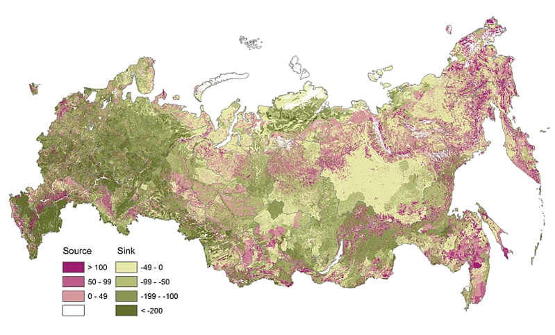
Full carbon account for Russia in 2009 – flux-based approach. All ecosystems of Russia in 2000-2010 served as a net carbon sink at 0.5-0.7 Pg per year. Uncertainty ~30% of this sink. About 90% was provided by forests (Shvidenko et al. 2011).

