 The Russia.Geo-Wiki is a branch of the global Geo-Wiki Project. It provides a platform to visualize and validate land cover maps for Russia. Land cover is a crucial dataset for many ecological tasks. Since large differences occur between existing land cover maps, current ecosystem and land-use science lacks crucial accurate data. Volunteers are asked to review hotspot maps and determine, based on what they actually see in Google Earth and their local knowledge, if the land cover maps are correct or incorrect. Their input is recorded in a database, along with uploaded photos, to be used in the future for the creation of a new and improved land cover map.
In addition, Russia.Geo-Wiki presents regional carbon pool datasets, and makes them freely available for visualization, all overlaid on the Google Earth platform.
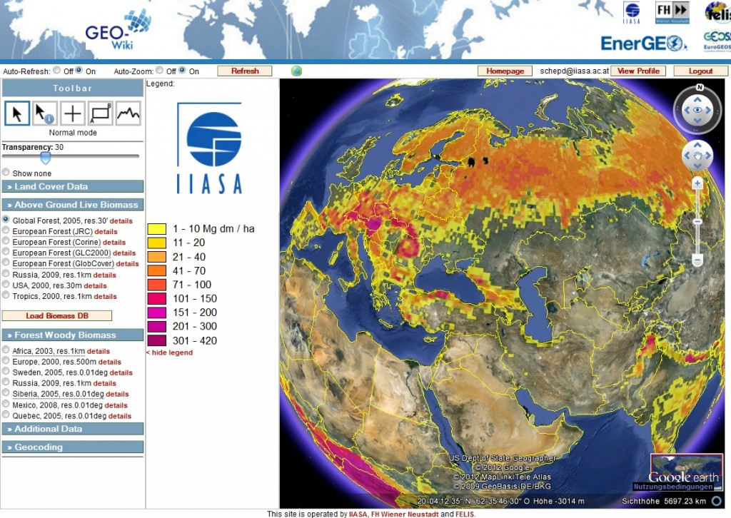 The Biomass.Geo-Wiki presents a collection of global, regional and in-situ biomass datasets produced by a number of institutions, overlaid on the Google Earth platform. The goal is to perform gap analysis, cross-product validation, possible harmonization and hybrid product development.